
Roles
How to Use Latapult
Bigger Data. Faster Maps. Stronger Decisions.
GIS Data and Mapping for All Roles

Land Evaluation
Data analysis offers clear value in making smart business decisions, but only if working with comprehensive and up-to-date information.
Discover More
Land Development
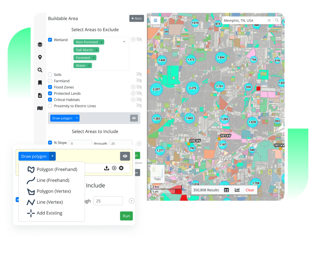
Land developers kick off projects knowing the specific criteria needed to be successful. Without consistent data for evaluation, land developers face layers of complexity.
Discover More
Land Acquisition
Whether working as a solo entrepreneur or for a large organization, land acquisition managers focus on selecting sites that maximize returns on investment.
Discover More Discover more about Land Acquisition
I no longer have to agonize over obtaining quality data, and clients tell me all the time that our information and packages are the best they’ve ever seen. Latapult gives me the tools that make that possible.

Chuck Mitchell
Senior Commercial Associate GA and SC , Parker Scott Properties
I really liked Latapult’s simplicity. It’s nice we don’t have to pay for a huge data set if we don’t need it. We value Latapult, and it’s not more than we need.
Henrietta Conrad
Real Estate Professional , Shingle Creek Capital
Latapult’s information is more detailed and updated than other GIS information. I can do things in Latapult in 10 minutes that used to take hours.
Hillary Shipley
Principal , Colliers International


Blog
View all blogs3 Steps to Streamlining Your Real Estate Workflow with GIS

How GIS Technology Saves Time and Money During Site Selection

4 Ways Technology Can Help Your Buyers Evaluate Commercial Real Estate Investments

geothinQ Is Now Latapult
5 Ways GIS is Changing the Game for Real Estate Professionals

GIS Technology for Every Step of Your AEC Project
