Industries
Partner with Latapult and allow your industry expertise to shine through GIS and dynamic mapping.
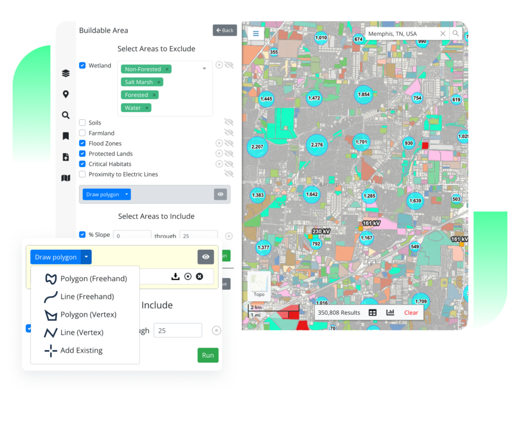
GIS Data and Mapping for Any Industry
Through comprehensive data, dynamic mapping, and collaborative tools, professionals across a number of industries can make land-smart decisions tailored to their goals.

Renewable Energy
Utility-scale and community renewable energy developers benefit from critical insights that take the guesswork out of land evaluation, acquisition, and development.
Discover More Discover more about renewable energy
Residential Development
Homebuilders gain a better way of planning, preparing, and executing on the build of a subdivision or residential project to keep up with housing demand.
Discover More
Commercial Development
Commercial real estate professionals can identify what makes a location unique by relying on up-to-date parcel data for understanding all the key details.
Discover More
Architecture, Engineering, and Construction
Architects, civil engineers, and construction firms use Latapult to visualize and detail site plans before, during, and after construction.
Discover More
Economic Development
With detailed data and maps of their communities, economic developers can better plan strategic improvements and better sell business planners on moving to the area.
Discover More
Site Selection
Site selectors can easily assess the characteristics of land that will help or hinder growth for their clients.
Discover More
Utilities
Latapult provides utility managers and operators with external infrastructure data to validate capital improvement planning and a centralized place to manage work orders and service.
Discover More