GIS Data to Power Land Intelligence
Latapult offers comprehensive, up-to-date land data and project-transforming insights for clients.

Centralized
Our platform acts as a centralized hub that contains millions of dollars of GIS data, powering environmental, demographic, geospatial, and topographic insights.

Nationwide
Our extensive GIS data coverage facilitates quality land searches for both large-scale and local queries, so you can stay one step ahead no matter where your business takes you.

Regularly Refreshed
Our data is the most comprehensive you’ll find, updated on a monthly, quarterly, or yearly basis, depending on trusted provider sources.
Latapult’s GIS Software Features In-Depth Datasets

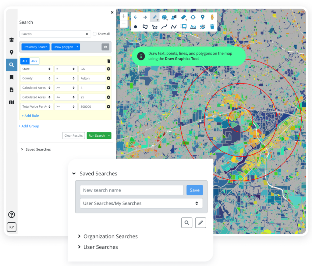
Parcel Data
Capture detailed parcel information to assess property and building attributes based on ownership, value per acre, addresses, property and market values, transaction information, and more.

Land Data
Determine the potential of vacant land, sorted from parcel boundaries, based on factors including building footprints, value per acre, improvement value, land transactions, and land use categories.
Transaction Data
Gauge various markets by area with records of residential and commercial parcel transactions including insights into volume, sale price, price per square foot, acreage, tax values, year built, and more.

Zoning Data
Keep track of the ever-changing nature of zoning districts and ordinances with easily accessible zoning code and zoning type data.

Points of Interest Data
Find land in proximity to desired features and amenities such as banks, business and services, construction and manufacturing, convenience stores and gas stations, education, entertainment and recreation, food services, government and public service, grocery, healthcare, lodging, miscellaneous, religion, retail, and transport.

Wetlands and Water Data
Analyze natural resources for adaptive management, geospatial summaries, and modeling based on forested wetland, non-forested wetland, salt marsh, water, stream, river, canal, ditch, pipeline, connector, underground conduit, and coastline information.

Economic Data
Decide where to invest in or develop with details on Federal Opportunity Zones, New Market Tax Credit Census Tracts, Qualified Census Tracts, and more – determining site value based on economic benefits.

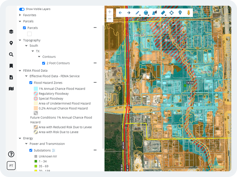
Topography Data
Plan for smarter land use with topography data that includes percent slope for the contiguous USA; four classifications of 0-5%, 5-10%, 10-25%, and greater than 25% slope; and USGS national elevation information.

Soil Data
Whether avoiding detrimental soil types or exploiting quality soil best suited for crops, balance risk and reward with data on hydrologic groups, drainage class, depth to bedrock, USGS seismic hazard map, and prime farmlands.

Energy Data
Take advantage of necessary electric infrastructure by determining property proximity to existing service areas, power and transmission lines, and substations.

FEMA Flood Data
Carefully plan for risk with insights into changes since last FIRM, effective, preliminary and pending national flood hazards, and National Risk Index to identify communities most at risk for 18 natural hazards.

Census Data
Gain a clear, concise breakdown of all census demographics vital to the makeup of an area like population, age, sex, race, household income and occupancy, home values, mode of transportation, migration, job industries, commute times, and more.

USA Data
Estimate federal opportunities with USA-specific data on economic events, telecom, buildings, civic, conservation, education, EPA, land cover, places, and more.

Transportation Data
Choose the road to success by investing in land nearest desired transportation routes such as roads and railways, ports and airports, and more, while also identifying busy areas based on traffic count.

Custom Data Layers
If you need to import attribute-level data, or integrate with other systems like a CRM, you may need Latapult Custom. Let our team of GIS experts tailor our software to your organizational needs.
Latapult's Changelog
Data is essential, but ever-changing. We never stop searching for new datasets to add to our platform and are always improving, refining, and expanding how our clients can apply GIS data to understand land.
Thorough and up-to-date information is our backbone. Our data is refreshed on a monthly, quarterly or yearly basis, depending on our trusted provider sources. Curious when our data was last updated?