
Why Latapult?
Bigger Data. Faster Maps. Stronger Decisions.
Premiere GIS Mapping Software
Learn More Learn more about Latapult’s Products
Comprehensive Land Data
Access millions of dollars worth of regularly updated GIS data, powering environmental, demographic, geospatial, and topographic insights.

Location-Smart Decisions
Simplify complex data to confidently problem-solve and make validated business decisions.

Seamless Collaboration
Combine dynamic GIS mapping with your industry expertise to easily track projects and site status, and share plans and information both internally and externally.

Trusted Partnership
Get personalized support from our in-house geospatial experts when you need it.

Always Evolving
Have geospatial experts in your corner constantly improving, refining, and expanding how you can apply GIS and use maps to understand land.

Versatile and Accessible
Use our GIS software anytime, anywhere. If you have access to the internet, you have access to Latapult.
Tools and Features
Our high-performance GIS mapping software includes tools for land evaluation, site selection, and development – powered by rich data layers for both large-scale and local queries.
From interactive charts and custom graphics to buildable areas and data import tools, our scalable, easy-to-use features help clients execute successful projects all while speeding up operations and building relationships.
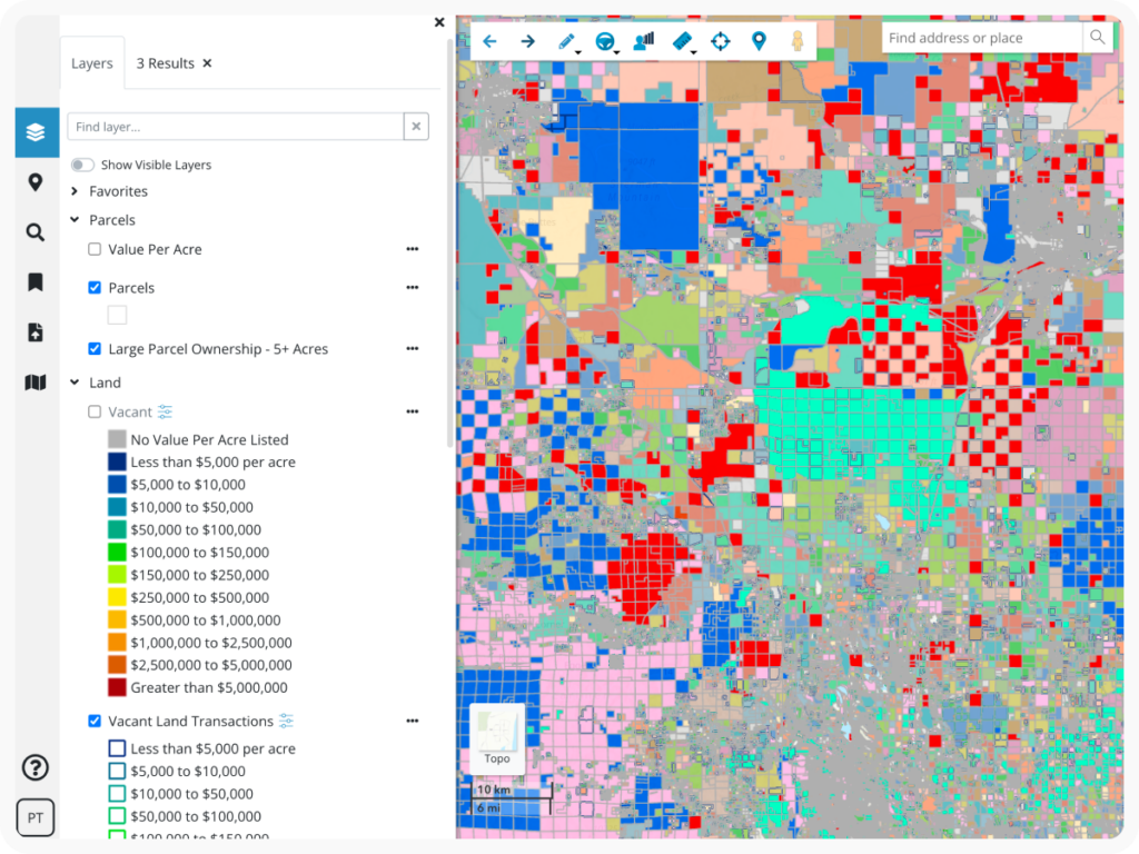
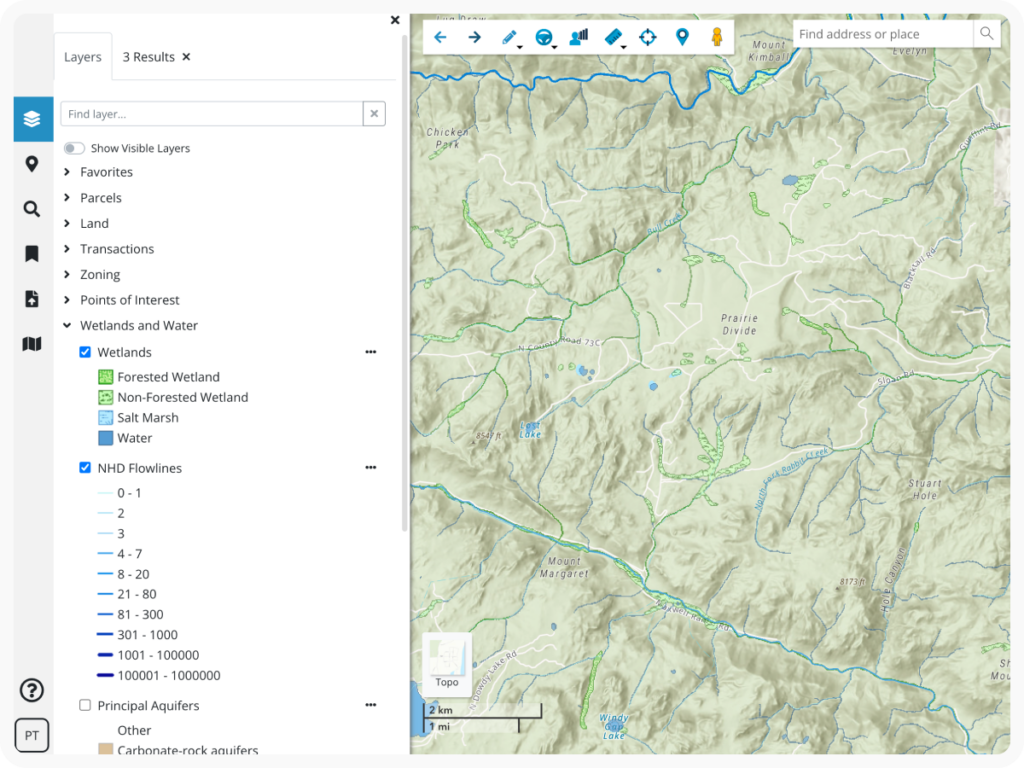
Available Data
Our comprehensive, frequently updated data eliminates manual research processes — providing faster access to the insights and clarity you need to move projects forward.
Latapult provides coverage of wetlands, elevation, soils, FEMA, electric, national historic places, HUBZone data, wind data, points of interest, land zoning, census data, traffic counts, roads, municipal boundaries, flood hazard zones, large parcel layers, and much more!
Changelog
Thorough and up-to-date information is Latapult’s backbone, and our clients gain access to millions of dollars of GIS data spanning across the entire nation.
It is the most comprehensive you’ll find, refreshed on a monthly, quarterly or yearly basis, depending on our trusted provider sources. Curious when our data was last updated?

Custom Layers and Integrations
If you need to import attribute-level data, level up your workflows with project tracking, or integrate with other systems like a CRM, you may need Latapult Custom.
Our team of GIS experts can tailor our software to your organizational needs.
How is Latapult different?
|
|
LandVision
|
Land id™
|
|
|---|---|---|---|
| High DPI map printing quality | |||
| No GIS experience needed | |||
| Monthly subscription available | |||
| Comprehensive parcel data | |||
| Comprehensive electricity data |
FAQs
-
What devices do Latapult work with?
-
Do I need to understand GIS software to use Latapult?
-
What regions does Latapult cover?
-
How often is Latapult’s property data updated?
Put your trust in experienced hands
-
300+
Businesses nationwide
Supported in uncovering insights that transform projects.
-
50x
Faster land research
To justify, approve, and negotiate land deals quickly and strategically.
-
$1K+
In savings a month per user
On resources, labor, and more.
-
$1M+
In GIS data
Powering environmental, demographic, geospatial, and topographic insights.


3 Steps to Streamlining Your Real Estate Workflow with GIS

How GIS Technology Saves Time and Money During Site Selection

4 Ways Technology Can Help Your Buyers Evaluate Commercial Real Estate Investments

geothinQ Is Now Latapult
5 Ways GIS is Changing the Game for Real Estate Professionals

GIS Technology for Every Step of Your AEC Project
