GIS Software for Residential Real Estate Development
Latapult’s dynamic GIS software and comprehensive data empowers residential real estate developers to make business decisions with confidence.


The challenge
Demand is high and competition is steep.
Even as the economy fluctuates, one thing remains strong: the demand for housing. In their quest to keep up with demand, residential real estate developers also face fierce competition in finding quality land deals that meet specific criteria and community needs.
With success at stake, residential developers need to secure quality land that doesn’t break the bank.

The solution
GIS Software for Smarter Subdivision Development
The market is moving fast, so homebuilders need to move faster. Developers can significantly reduce the time spent on manual research, data gathering, and analysis using GIS software. Latapult arms teams with a better way of planning, preparing, and executing the development of a subdivision or residential project with up-to-date parcel data and effective tools that shed light on all crucial land details.
Find quality land deals that push you past the competition with Latapult.
We work with homebuilder clients nationwide in developing subdivisions. Put your trust in experienced hands.
-
300+
Businesses nationwide
Supported in uncovering insights that transform projects.
-
50x
Faster land research
To justify, approve, and negotiate land deals quickly and strategically.
-
$1K+
In savings a month per user
On resources, labor, and more.
-
$1M+
In GIS data
Powering environmental, demographic, geospatial, and topographic insights.
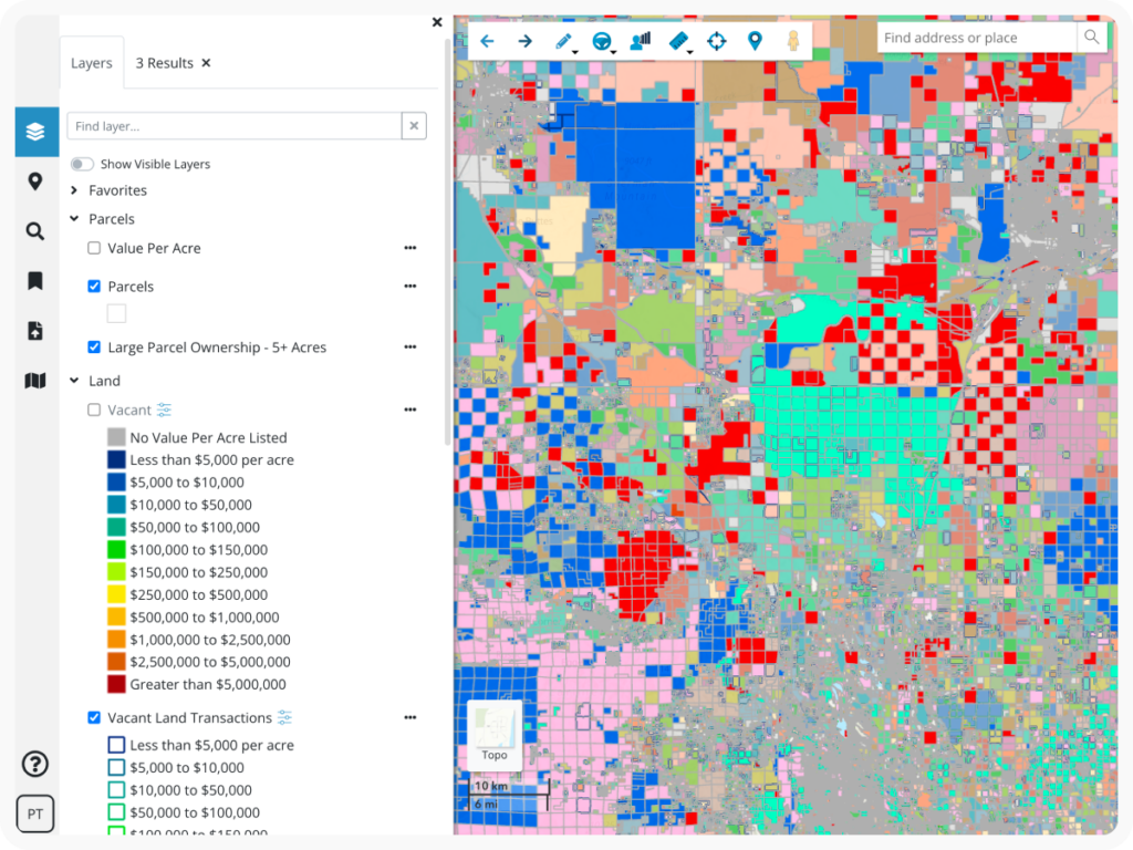
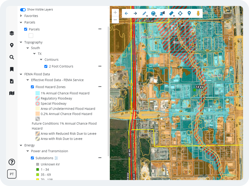
Comprehensive GIS Data for Residential Development
Latapult takes the guesswork out of determining the feasibility of residential development projects. Our platform includes up-to-date parcel data on land ownership, zoning, value per acre, flood zones, and more to help you determine the buildability of land and quality of deals. Our GIS software also houses census data, points of interest, and traffic count information to gain a better understanding of local community needs.
Latapult saves residential development teams time and money when making business decisions—ultimately improving ROI.
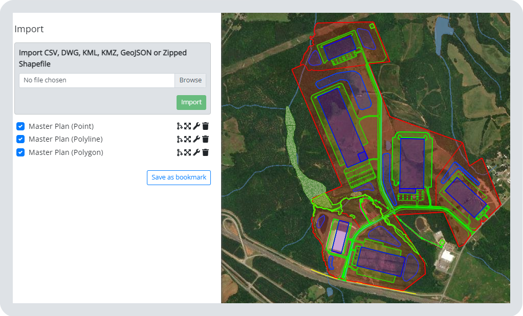
Dynamic GIS Mapping Tools for Sharing Site Plans
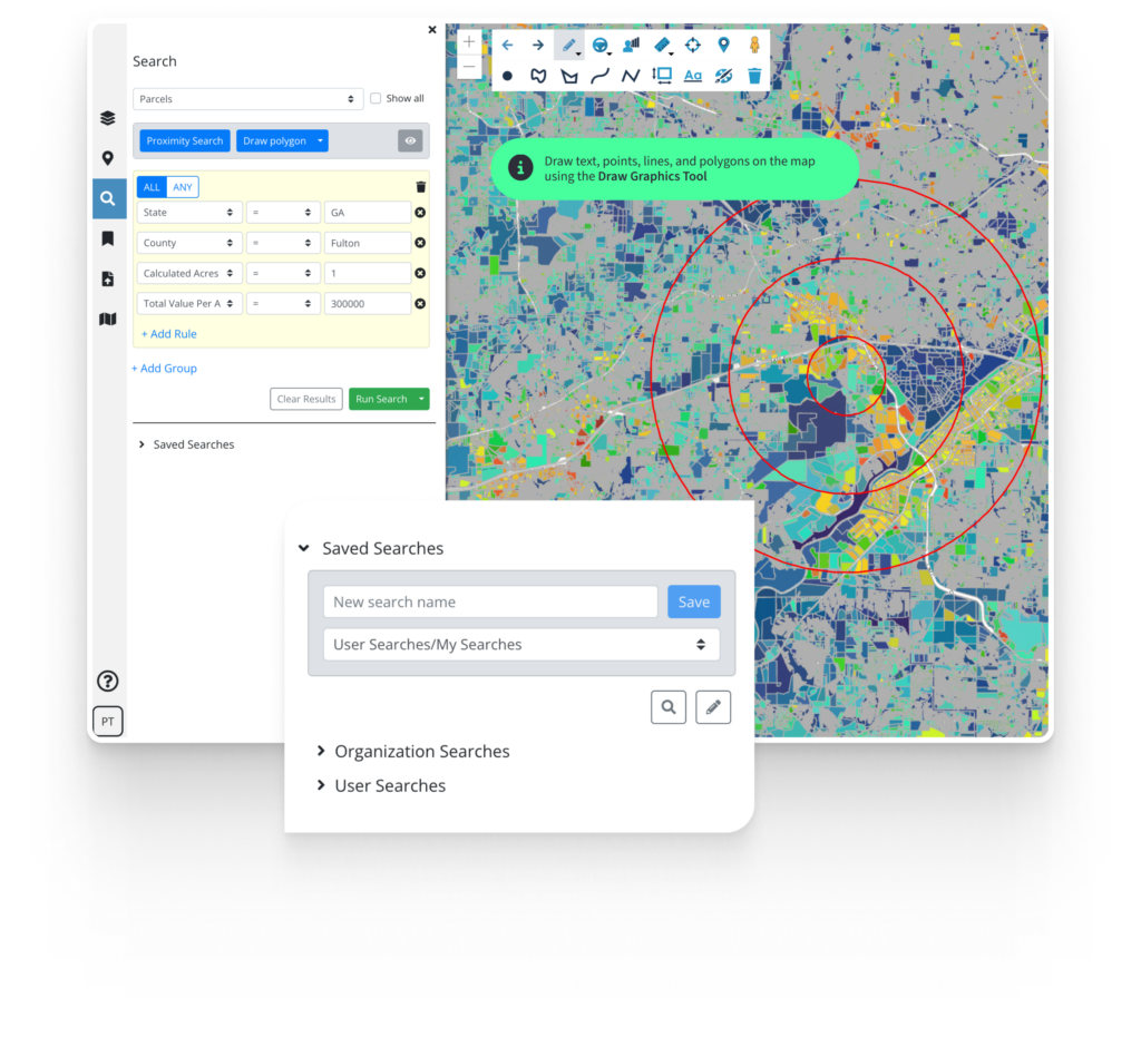
In addition to robust data, Latapult’s GIS software helps predict the success of a potential subdivision or residential project. By running search queries, you can test out site plan scenarios then access our measurement tools to give you an idea of what is happening around a location to ensure a residential development is near desirable amenities.
Get your ideas on the map, then export data tables and PDF maps of land with graphics and text to gain investor buy in.
Customizable GIS Software for Unique Needs
Sometimes organizations benefit from a tailor-made GIS platform. Whether they need to import attribute-level data, improve workflows with project tracking, or integrate with other systems like a CRM, our team of GIS experts can tailor our software to any organization.
We love helping clients take our data and collaboration tools to the next level to solve their unique challenges.