
GIS and the Site Selection Process
July 2, 2018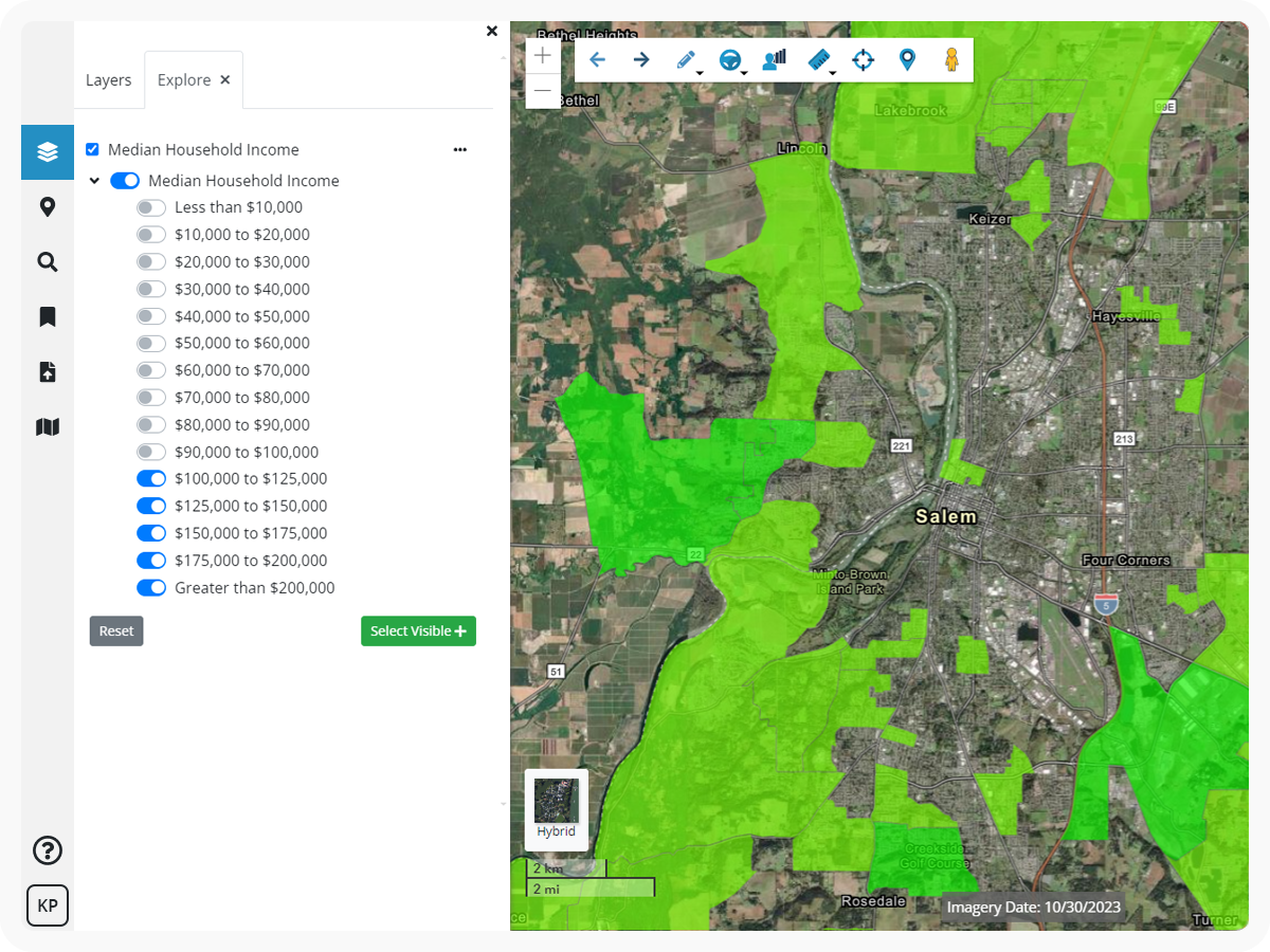
When it comes to selecting a perfect site to open a new location or relocate, companies spend a lot of time and money on the selection process due to things like site development, labor force, logistics, and connectivity that will affect the bottom line for years to come. This process can be quite overwhelming. Why waste precious resources when Geographic Information Systems (GIS) technology can help answer the all-important question of “where”? GIS is used by leaders of industrial complexes, residential developments, retail operations, corporate headquarters, data centers, and energy sites who want to bypass written reports and visualize and interact with data layers that will affect priorities and feasibility when selecting a site.
Access to the most sophisticated analysis methods and greatest wealth of resources are worthless if there is no way to quickly visualize the land-based data and observe how essential site features interact. With the analytical and data visualization capabilities of GIS, variables that affect the success of a site such as size and shape of property, environmental risks, proximity to a quality supply chain, prevailing government regulations, and the future employee or customer base come to life.
Check out the most common variables companies can visualize with GIS when it comes to choosing the perfect site:
Environmental Elements
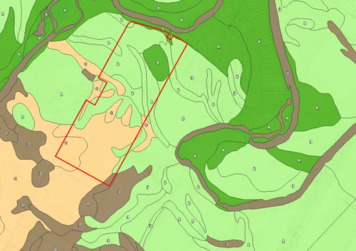
Knowledge of site-specific environmental characteristics can have a major effect on the siting of entire projects. This fact is often overlooked, especially when teams are considering multiple sites in a small area, relying on the assumption that closeness equates to consistent environmental features and regulations. Using multiple GIS data layers, users can overlay soil types, FEMA Flood Zones, EPA Facilities, the National Wetlands Inventory, and contour lines. Assembling related data layers on one screen portrays how drastically environmental and natural conditions can vary within a single site.
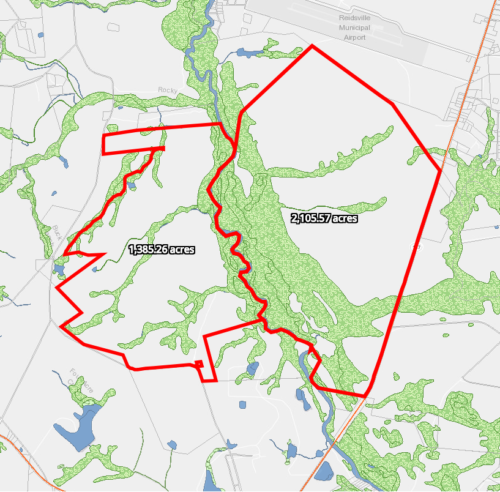
Site Size
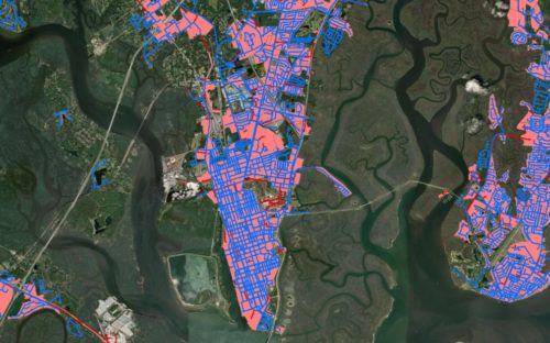
The most fundamental element of determining where to invest in a new property or development is the size and shape of the site. The ability to identify and search through parcel data layers comes standard with Latapult. Parcel data reflects value and overall size of land among other essential ownership and land information unique to the governing county or municipality. Measurement tools empower users to further explore elements of site size, capacity, and location in relation to nearby amenities and competitors. Measurement tools in Latapult include lines, polygons, and freehand drawing options, as well as area, distance, and approximate geographic coordinates.
Utilities
Access to existing utilities is a savvy method for companies determining a site to develop on. Using utility data, the distance to, and capacity of water or sewer systems can be determined. Understanding the location of needed utilities or the amount of impact fees levied by local governments may also lead to teams further evaluating an area for feasibility of alternative sources of energy, such as wind or solar.
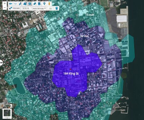
Traffic/Transportation
Moving freight can be costly, so an existing or proposed transportation network is key to goods successfully reaching distributors and customers. GIS transportation data, such as traffic volume, rail infrastructure, existing roadways, and access points, like ports and airports, can bring together all aspects of the existing logistics framework in relation to the area being assessed. Transportation analysis tools in Latapult include roads, rail, ports, and airports. Latapult’s drive and walk-time analysis considers physical barriers, helping users estimate how long it will take to reach a certain point.
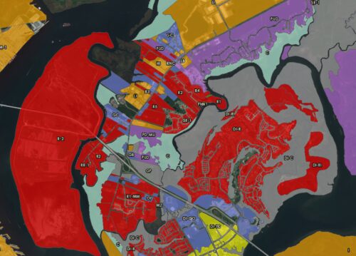
Entitlement Process
Obtaining permission to develop a property in the way a company desires is often met with regulations by state and local agencies. These authorities can often be the deciding factor on the aesthetic and functionality of a property. Access to GIS data, such as environmental overlays and zoning districts, give site selection teams the ability to envision the effect existing laws will have on the form and function of a building from how tall it can be, to the hours of a day it can operate. GIS data can help paint a more accurate picture of the leading authorities in an area like zoning, tax parcel data, property ownership information, and municipal boundaries.
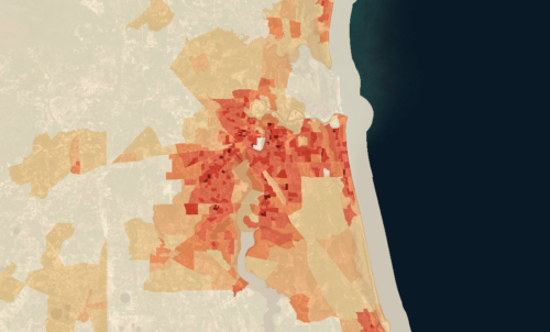
Demographics
A company may scout more than the physical property during site selection. Data about the population or workforce surrounding a future business or residential development, including average age, income levels, and educational attainment makes demographic information key in the site selection process. Census data illustrates an area by the demographic makeup of the people who reside there. It is reliable, expansive, and can be found in Latapult.
Ready to bring the power of GIS to your site selection? Visualize land data that is vital to your company or business’s decision to locate or expand your operations, get started with Latapult today.


