
Using GIS Mapping Software for Local Land Searches
April 16, 2021
Mapping technology like GIS can help a variety of industries conduct land searches in order to make smart and informed land decisions. But not every industry is looking for the same type of land. For instance, while some land stakeholders may be looking at land on a national scale, industrial real estate brokers and AEC firms often focus efforts on metro-specific land searches.
That’s why our GIS mapping software was designed with flexibility in mind to help meet varying industry needs, like metro or state-wide searches.
Using GIS Mapping Software for Metro-Scaled Land Research
From the research phase to development, AEC firms and industrial real estate brokers need GIS at their fingertips throughout the due diligence process. What’s unique about how these two industries use GIS is that they hone in on specific areas to help clients through site selection on a local scale.
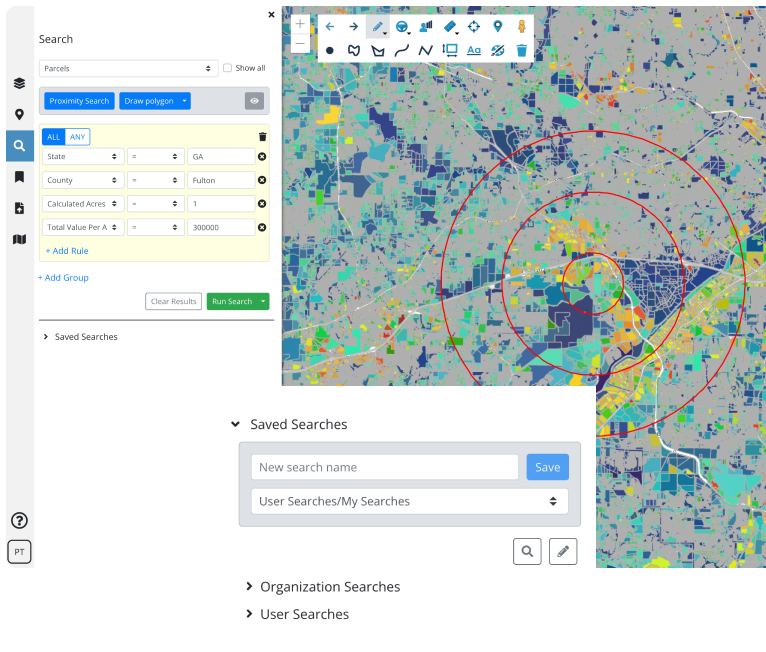
Latapult has land data spanning the entire United States, but land searches don’t have to be made on a national level. Our platform allows users to fit the software into varying workflows — including localized and statewide land searches.
With Latapult, firms and brokers can conduct searches of our land database based on site acreage, property ownership and beyond to respond to client inquiries. Additionally, Latapult provides the option to do more advanced land searches and provides answers to users’ in-depth questions on parcel data such as acreage of developable area or proximity to rails to better answer clients’ extensive questions around the buildability of a property.
How Latapult Users Integrate GIS Into Workflows
Despite industrial real estate brokers and AEC firms both using GIS for metro searches and improved client relationships, all industries can implement GIS into their workflows in different ways.
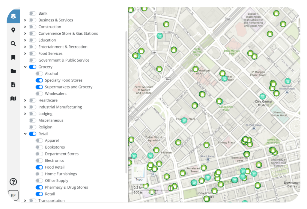
For example, industrial brokers often coordinate multiple land deals at a time which can be cumbersome to manage. For these professionals, Latapult can be used to not only easily evaluate land for potential development, but to efficiently manage a number of potential deals. For instance, we’ve had brokers use our platform’s pinning feature to keep information organized as they manage a number of different clients through the site selection process.
AEC firms, on the other hand, use GIS to make more efficient use of their team’s time and clients’ budgets. When conducting simple topographic map or parcel data research, firms can spend days collecting data from disparate sources, but with GIS, teams can do it in minutes. What’s more, with Latapult, users can get instant answers, giving project managers the opportunity to provide immediate responses to clients. For example, one AEC customer used Latapult to quickly determine property soil types so that their residential developer client would know which lots needed new soils.
Whether you’re planning to conduct metro-specific searches like our broker and AEC clients, or use searches on a grander scale, using GIS can improve your land searching process for current and future projects. Click here to learn more about our scalable GIS mapping software.


