GIS Software for Renewable Energy
Launch your renewable energy projects with Latapult’s dynamic mapping capabilities and comprehensive land data.


The challenge
Growing market demand means steep competition.
The renewable energy market is booming as states around the country prioritize resource development. Facing steep competition for land that meets specific criteria, utility-scale and community renewable energy developers need to make location-smart business decisions quickly and strategically.
Despite needed efficiency to keep up with demand, renewable energy professionals have historically spent hours or even days compiling necessary land data from inconsistent, disparate sources.
Misspent time can lead to wasted money, expanded project timelines, strained client relationships, and more.
The solution
GIS Software for Renewable Energy Land Data
Latapult provides a better way to gather, manage, and evaluate the land data you need, bringing you clarity in mere minutes. Latapult is a comprehensive site selection software that powers data-validated, location-smart business decisions with collaborative, dynamic mapping to outpace competitors to better land deals.
Rather than tracking down available property data and sifting through multiple sources to find out if prospective land checks all the boxes for a renewable energy development, clients can search, manage, and evaluate land data in Latapult based on exact criteria.
We work with Renewable Energy clients nationwide. Put your trust in experienced hands.
-
1,000+
Hours saved
By renewable energy clients using our GIS software.
-
$1M+
In GIS data
Powering environmental, demographic, geospatial and topographic insights.
-
125K+
Pins and bookmarks saved
By renewable energy clients in a single year.
-
165K+
Search queries
Conducted by renewable energy clients in a single year.
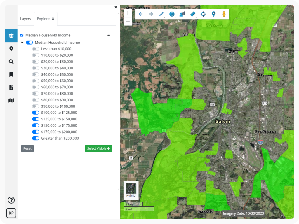
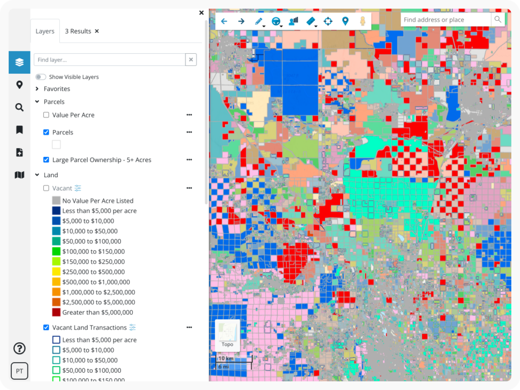
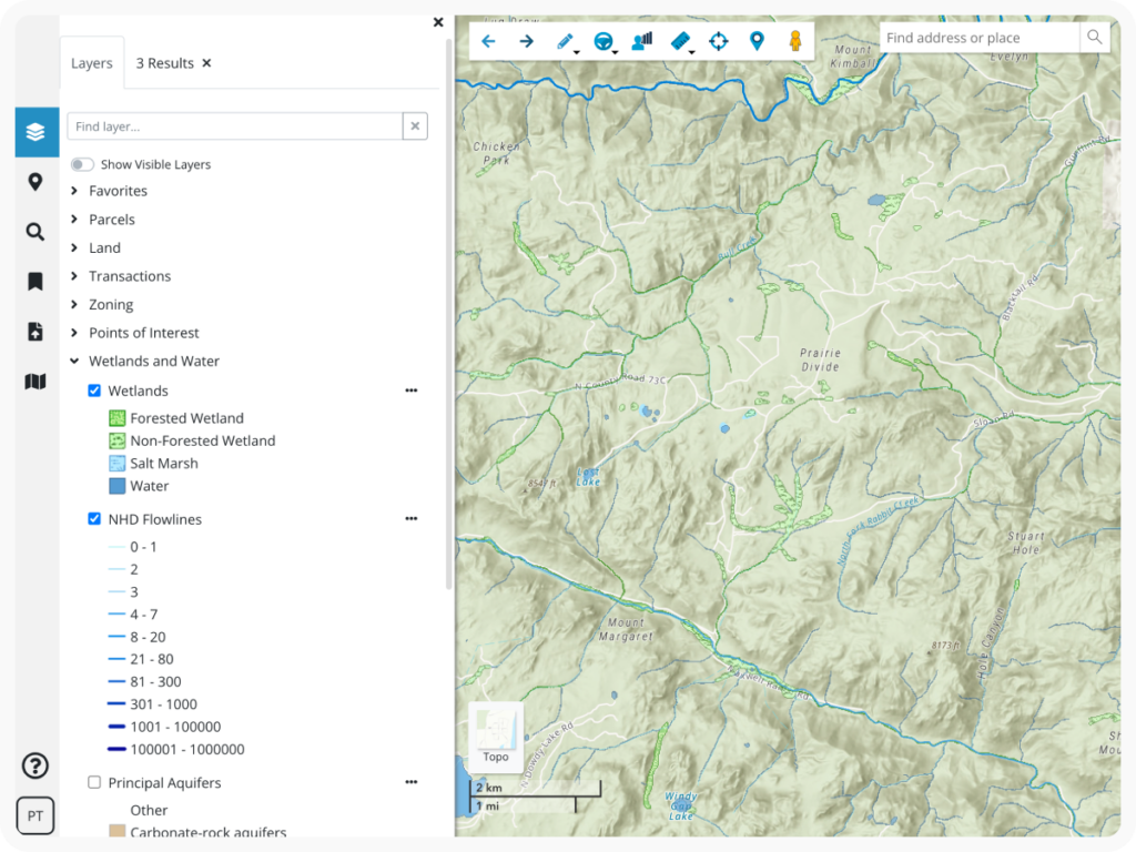
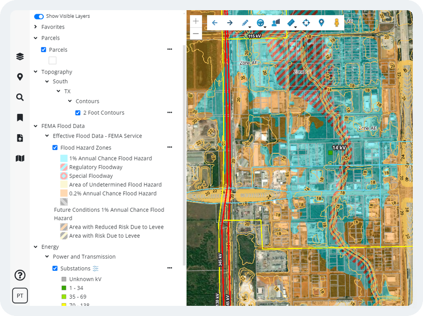
GIS data for Renewable Energy
We arm our renewable energy clients with the most comprehensive, up-to-date data spanning the entire United States. Our data includes information detailing transmission lines, substations, acreage, boundaries, wetlands, flood risk, zoning, LiDAR topography, and more.
Take the guesswork out of evaluating, acquiring, and developing renewable energy projects with Latapult.
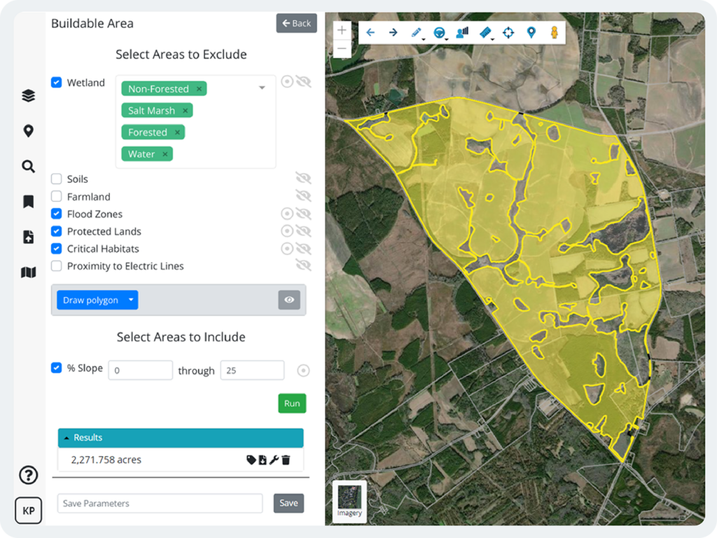
GIS Mapping Tools for Evaluating Land
Data is important, but it is how we interact with data that truly makes projects successful. Dynamic mapping tools, including our buildable area evaluator, graphs, charts, and more, empower our renewable energy clients to strategize and problem solve for high-impact project results.
Manage project plans and create interactive presentations with Latapult to lay the foundation for successful development.
Customizable GIS Software for Unique Needs
Sometimes organizations benefit from a tailor-made GIS platform. Whether they need to import attribute-level data, improve workflows with project tracking, or integrate with other systems like a CRM, our team of GIS experts can tailor our software to any organization.
We love helping clients take our data and collaboration tools to the next level to solve their unique challenges.