GIS Software for Commercial Real Estate Development
Latapult’s dynamic GIS software and comprehensive data powers confident real estate investments.


The challenge
Armed with a plethora of online resources, CRE clients demand deeper insights.
Commercial real estate professionals are no longer the only go to source for providing advice on investing. Clients have access to land and real estate data at their fingertips with a number of online resources, making them both more knowledgeable and more demanding than ever.
When the location and logistics of a development can make or break a business, CRE professionals need a clear understanding of the market to gain an edge over the competition, including online sources, and to meet client needs.

The solution
GIS Software to Validate CRE Development Decisions
Successful commercial real estate development depends on the physical location of a property and how land features impact new builds. Latapult allows you to identify unique characteristics with up-to-date parcel data and collaborative tools.
Use Latapult to better serve your clients, providing a clear understanding of the commercial real estate market and the factors that affect development.
We work with commercial developer clients nationwide. Put your trust in experienced hands.
-
300+
Businesses nationwide
Supported in uncovering insights that transform projects.
-
50x
Faster land research
To justify, approve, and negotiate land deals quickly and strategically.
-
$1K+
In savings a month per user
On resources, labor, and more.
-
$1M+
In GIS data
Powering environmental, demographic, geospatial, and topographic insights.
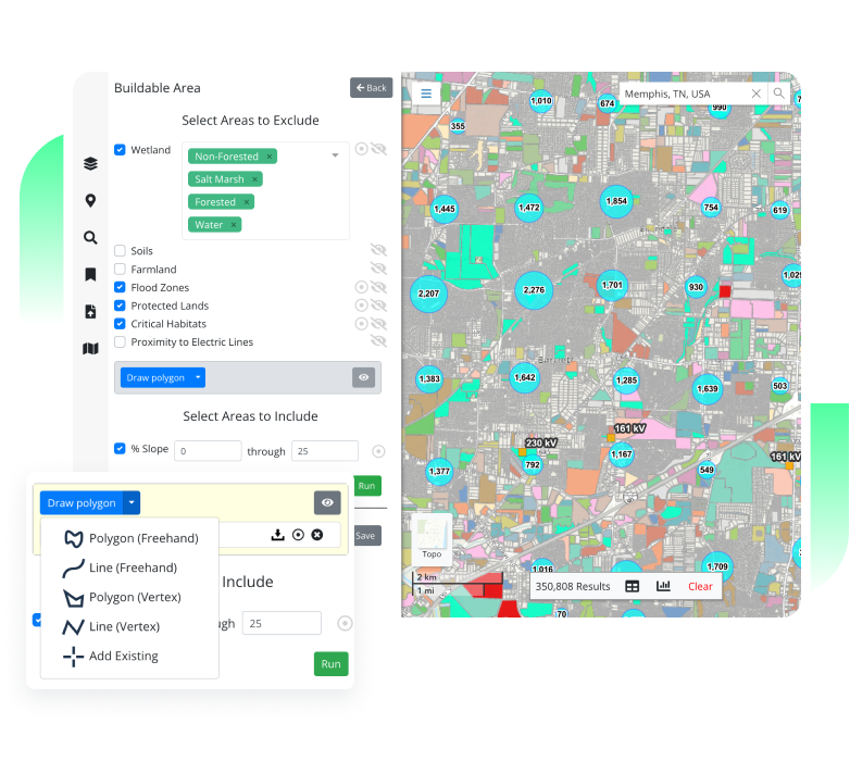
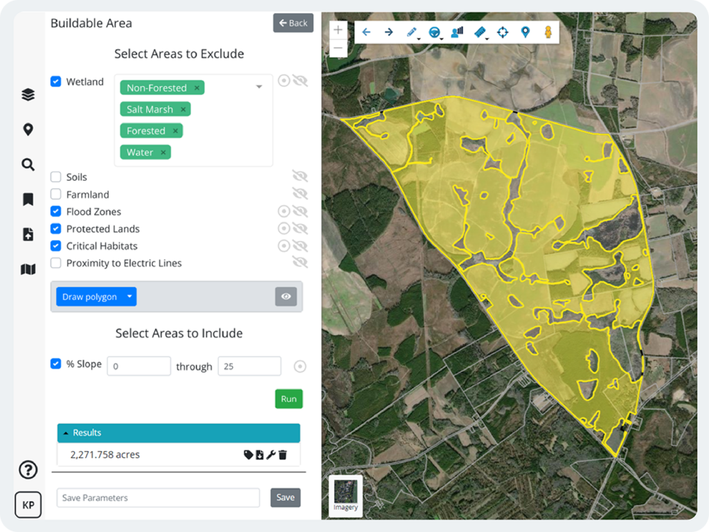
Determine feasibility of commercial developments with GIS data.
Commercial real estate development success depends on location. Latapult provides market data to evaluate existing commercial developments and trends in an area that takes the guesswork out of determining the feasibility of development projects. Our data includes, up-to-date parcel information on land ownership, zoning, value per acre, flood zones and wetlands, municipal boundaries, census data, points of interest to local amenities, traffic counts, and more. Plus, Latapult custom users can also import their own data into the platform.
Latapult saves commercial development teams time in collecting information for clients—ultimately building trust and loyalty.
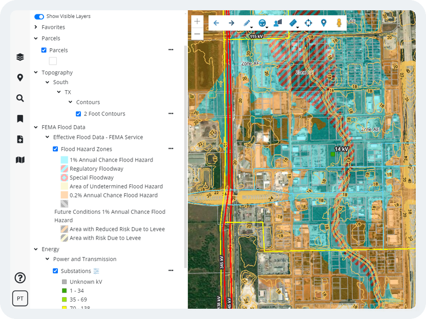
Dynamic GIS Mapping Tools for Evaluating Land
Beyond simple data access, Latapult’s GIS tools allow you to answer client questions about a piece of property by running queries to test out site plan scenarios. We have measurement tools to give you an idea of what is happening around a location with points of interest and travel areas to ensure a commercial development is near desirable amenities.
In a technology-centric world, visuals communicate things that an email or even face-to-face conversation cannot. Exporting data tables and PDF maps of land with graphics to personalize a map is the key to building client confidence.
Customizable GIS Software for Unique Needs
Sometimes organizations benefit from a tailor-made GIS platform. Whether they need to import attribute-level data, improve workflows with project tracking, or integrate with other systems like a CRM, our team of GIS experts can tailor our software to any organization.
We love helping clients take our data and collaboration tools to the next level to solve their unique challenges.