
Answers to AEC Firms’ Top 5 GIS Questions
February 4, 2021
Despite the many benefits of geographic information systems (GIS), AEC firms are sometimes hesitant to adopt the technology. Why? Often, it’s because they do not have a full grasp on when and how the software can be used, which platforms provide the best data to make more informed land decisions, or how to integrate it into their existing workflows.
That’s why our team of experts provided answers to some of the top questions we hear from customers and prospects on how GIS can help AEC firms succeed:
1. Where does GIS fit into my AEC workflow?
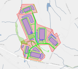
From site selection to project management, firms can use GIS for every step of their AEC project. For example, we’ve seen customers guide clients through the site selection process by using GIS to provide smart counsel based on rich land layers such as zoning, wetland, topography data and more.
After land has been selected, customers have then used GIS to create land development scenarios by importing site plans to better visualize upcoming developments for their clients. But most importantly, throughout the entire process, AEC firms need tools that keep their teams organized. That’s why they use GIS-based project management tools to collaborate and share data and maps among the entire AEC team.
2. What makes Latapult data unique from other land development software?
Latapult gives AEC firms access to the data they need for land development projects all in one place. Our parcel data is available nationwide, and unlike many other sites, is updated quarterly. Additionally, our high-performance data layers included in each Latapult package are what make the application unique. Firms can scope a site for elevation changes, wetlands, soil types, FEMA flood zones, nearby points of interest, demographic information, and more in just a few clicks.
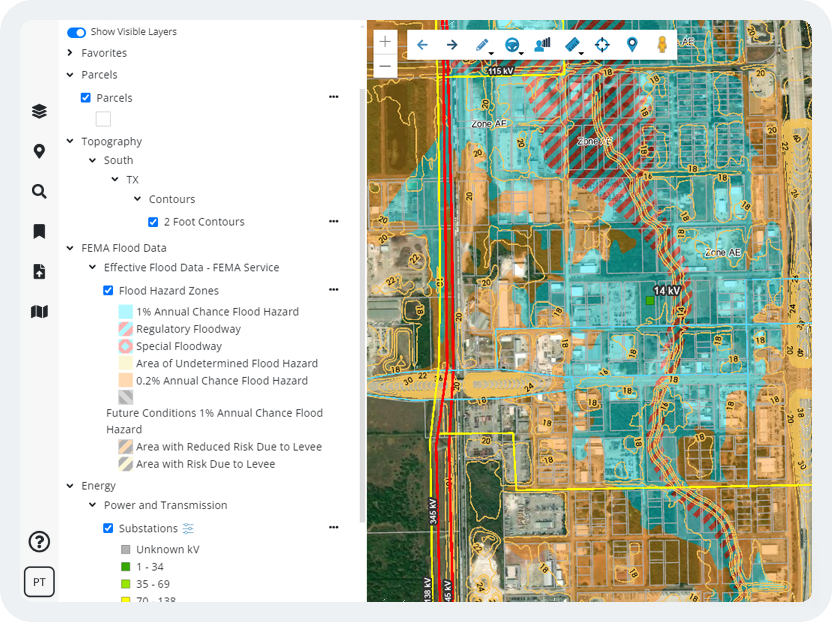
Our data sets are acquired and reviewed by our team of GIS analysts who understand how AEC firms want to interact with their data. We make it easy to search for property across county lines that meet exact specifications. With our easy-to-use application, we’re putting the power of GIS data into the hands of all land stakeholders. All users need to know is how to use the Internet!
3. What tools are included in Latapult, and how do they improve my workflow?
Latapult knows that you don’t have time to jump between different applications to view and interact with data. That’s why we have built dozens of tools that allow you to do much of your work all within the application. When used alongside our pre-assembled data layers, our versatile graphics tools allow you to customize and create PDF maps of your projects that can easily be shared with clients and business partners. Use these graphics along with the bookmarks tool to create interactive presentations where you and your client can explore properties near your project. Wherever you are in your project, our application has tools that can aid and improve many areas of your current workflow.
Latapult has even more built-in features such as travel areas, reports, and data charting. Click here to see all of these features and more in action.
4. How do I use other systems like CAD along with GIS?
GIS was not designed to replace systems like CAD but can work alongside this technology to enhance the site design process. For example, AEC firms can import CAD site layouts to quickly visualize those plans against dozens of Latapult layers for a fast, in depth look at the surrounding environment. This can ultimately improve productivity and boost project management by allowing GIS data layers and site design layouts to live cohesively on one platform.
5. How can I track projects and share information with my team?
GIS can be an effective tool for team alignment and management. Using bookmarks, managers can save site boundaries and create an inventory of active or prospective projects. These bookmarks can then be shared with other members of your team or exported to share boundaries with a client. To further track projects, users can also add pins to each site and attach related documents. Not only can you share these pins with other members, but users can create pin groups – a collaboration space where everyone can create and edit pins and see changes happen live.
Ready to improve your team’s workflow and better serve your clients? Click here to learn about the many ways your firm can use Latapult to succeed.


