
GIS Software for Architecture, Engineering, and Construction
Latapult helps AEC firms provide clients with data-backed counsel.


The challenge
Competition for clients is fierce.
Clients want to work with an architecture, engineering, and construction firm that can provide strategic guidance throughout the entire land evaluation, acquisition, and development process. With thousands of firms in the U.S., it is increasingly difficult to stand out among the competition. On top of securing and properly retaining clients, AEC firms are challenged with managing large teams across various practices.
Outdated processes can drain AEC firm employees’ time and energy and create extra expenses for clients—leading to expanded project timelines and strained client relationships.

The solution
GIS Software for Architectural, Civil Engineering, and Construction Firms
Be your clients’ most trusted AEC partner by helping them make smart decisions backed by data, insights, and your expert recommendations. With Latapult, you can streamline workflows from top to bottom while strengthening client relationships. Our dynamic mapping tools are designed to gather, manage, evaluate, and share the land data you and your clients need.
Don’t waste your team’s time or your client’s money on manual research. Latapult eliminates the need to jump between applications just to view and interact with incomplete data. With Latapult, you can even overlay your site plans and data, so you’ll get all the information you need in one place.
We work with architecture, engineering, and construction clients nationwide. Put your trust in experienced hands.
-
300+
Businesses nationwide
Supported in uncovering insights that transform projects.
-
50x
Faster land research
To justify, approve, and negotiate land deals quickly and strategically.
-
$1K+
In savings a month per user
On resources, labor, and more.
-
$1M+
In GIS data
Powering environmental, demographic, geospatial, and topographic insights.
GIS for AEC Firms
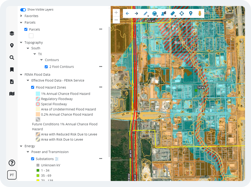
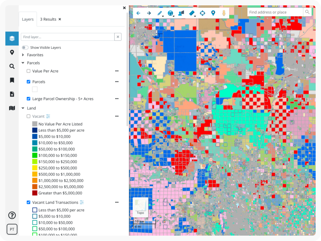
When clients ask specific land questions, we arm AEC firms with instantaneous data-backed answers. Our platform includes information detailing transmission lines, substations, acreage, boundaries, wetlands, flood risk, amenities, LiDAR topography, and more.
Latapult gives your team a holistic view of external factors impacting project outcomes, resulting in clients who feel informed and confident.
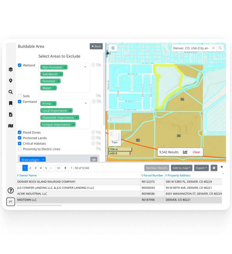
Dynamic GIS Mapping Tools for Evaluating Land
Data is important, but it is how we interact with data that drives success. GIS mapping tools, including our data import tools, buildable area evaluator, graphs, charts, and more, help AEC firms create realistic project scenarios to help their clients strategize and problem solve for high-impact project results.
Manage dispersed teams and create interactive client presentations with Latapult to lay the foundation for successful client developments.

Customizable GIS Software for Unique Needs
Sometimes organizations benefit from a tailor-made GIS platform. Whether they need to import attribute-level data, improve workflows with project tracking, or integrate with other systems like a CRM, our team of GIS experts can tailor our software to any organization.
We love helping clients take our data and collaboration tools to the next level to solve their unique challenges.


Resources for AEC Firms
View all blogsHow AEC Firms Achieve True Collaboration Through GIS Technology

Answers to AEC Firms’ Top 5 GIS Questions

GIS Technology for Every Step of Your AEC Project

Use Cases and Benefits of Latapult’s Buildable Area Tool on Land Evaluation and Site Assessment

GIS Provides Land Developers A Blueprint for Site Evaluation
