
Two Heads Are Better Than One: GIS Teams Need Latapult
May 2, 2023
Every day, professionals around the world use GIS to make business decisions. These experts must piece together dozens of different pieces of information from various sources to determine site suitability. But with the right technology in hand, GIS teams can bring all this crucial data together, enabling better, faster project decisions. The right technology empowers experts to collaborate with colleagues who may not have a full grasp of how to use GIS. By having all the data in one place, different organizational departments can all get on the same page about a project.
Learn how your GIS team can fully benefit from the power of Latapult.
Why a GIS Specialist Still Needs GIS Software
Without a single, centralized software, GIS specialists must manually pull information from dozens of different data resources — a time-consuming process. They will also spend time on other tedious tasks, such as searching for nationwide data, symbolizing maps, processing large datasets, and more. In fact, for every hour of manual work our customers complete, they save an estimated 4 hours by using Latapult instead!

However, when using specific GIS software, like Latapult, GIS teams can reduce many of these manual or time-consuming processes, allowing them to focus on analysis, preparing materials for prospects and clients, and team collaboration – ultimately boosting their businesses’ ROI. By using GIS software to improve some processes – i.e. creating visuals and maps about land information that can be further used in educational presentations for the broader team – GIS experts have more time to fully dive into each of their projects and communicate with their teams.
How your GIS Team Can Integrate with Latapult
No matter what industry they’re in, it’s important for GIS teams to be armed with software that lets them bring all their work into one place. By integrating your existing project data into Latapult, our software can change the way your team works – both individually and as a group.
There are two primary ways to integrate your existing GIS team with Latapult:
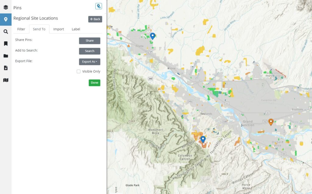
- Import or Export: GIS teams can export data such as pins and graphics or project boundaries determined in Latapult into their own internal GIS software or workflow. They can also import data as graphics or pins (like site plans, project layouts, or boundaries) and overlay it on Latapult’s datasets.
- Custom Plan: GIS teams can also subscribe to a custom plan with Latapult to create, edit, and maintain their own datasets while gaining all the benefits of Latapult.
Latapult was designed to easily integrate with your team’s current workflow, making project collaboration simple, while giving your team more power to complete projects with up-to-date information.
Latapult was built to support all land stakeholders, including your GIS team. Let your GIS expert give it a try — sign up for a free trial today.


